
Land Surveys for the Cemeteries in the Constellation of Living Memorials

Albert Carver Cemetery

W.W. Glover Cemetery

El Campo Santo de Cemento Grande Cemetery

Oakland Cemetery

Western Heights Cemetery

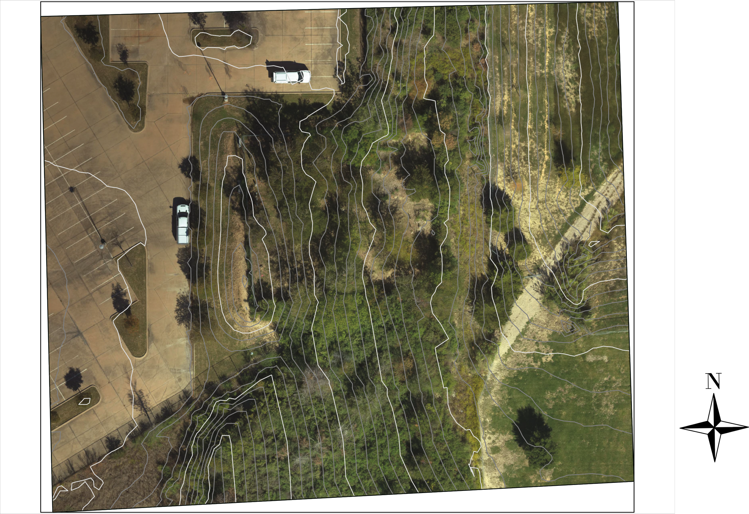
Beeman Memorial Cemetery

Survey + Topographical Line Drawing of Beeman Memorial Cemetery

Survey + Topographical Line Drawing of Albert Carver Cemetery
Survey + Topographical Line Drawing of El Campo Santo de Cemento Grande Cemetery

Survey + Topographical Line Drawing of Albert Glover Cemetery

Survey + Topographical Line Drawing of Oakland Cemetery

Survey + Topographical Line Drawing of Western Heights Cemetery
Members of the Texas Society of Professional Land Surveyors, Dallas Chapter 5 conducted all the topographical and tree surveying at the eight historic cemeteries participating in the Constellation of Living Memorials Two-Year Pilot Program, pro-bono! Thank you to Chris Freeman of Lina T. Ramey & Associates, Inc. Engineers, for leading this effort with the Smartdrone staff, conducting the aerial missions with drone and lira technologies currently at the Oak Cliff Cemetery.
Michael Ash — UAV Pilot from Smartdrone (Tyler, TX)
Chris Freeman — Survey Program Manager from Lina T. Ramey & Associates, Inc. (Texas Headquarters in Farmers Branch, TX)
Shannon Roberts — Volunteer (Tyler, TX)
Mason Smith — UAV Pilot from Smartdrone (Tyler, TX)
In addition, Lina T. Ramey & Associates, Inc. survey crew members Matt Simonson and Matt Alvarez set survey control at six of the historical cemeteries, utilizing cutting-edge GPS receivers, enabling the aerial data collected by the UAV LiDAR missions to be referenced to real world coordinates and elevations. This facilitates the surveys to be located geographically in the correct location and relative to the real world.
Lina T. Ramey & Associates, Inc. office staff members, Grant Hobbs and Davin Ewbanks performed record research of the cemetery properties.
Further data processing has created a topographic file with a 10 foot grid and a one foot contour interval that the landscape architect can utilize for their work.
Cemeteries included in this survey: Albert Carver, Beeman, W. W. Grover, Oakland, Western Heights, Santo de Cemento.
Pat Baldasaro, President of PJB Surveyors will conduct the work at Persimmon Rd and Oak Cliff Cemeteries.
Click on any of the images above to enlarge and view the details captured by these amazing volunteers.